

Three lives of one crossing
Old Seven began as part of the Florida East Coast Railway's extension to Key West. The crossing opened in 1912, an extraordinary feat of railroad construction over open water. After the 1935 Labor Day hurricane ended through-rail service, the former rail route was adapted for automobiles. The present Seven Mile Bridge took over highway traffic in 1982.
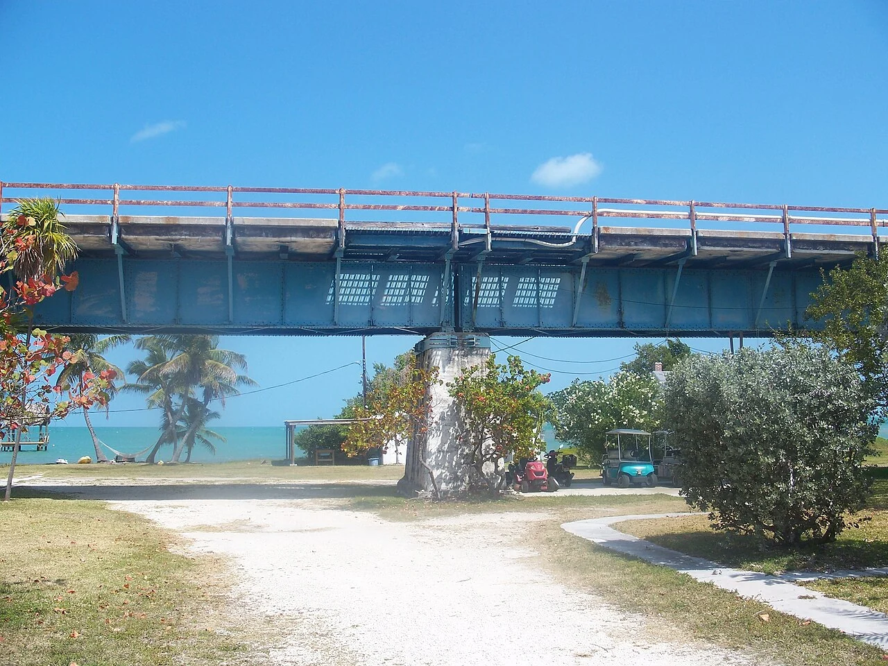
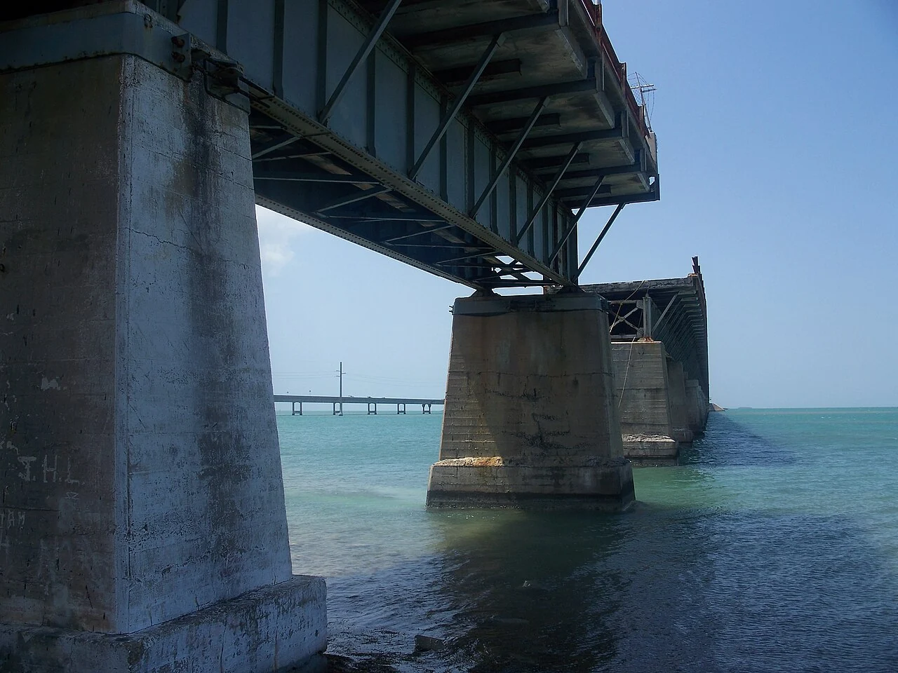
Those changes explain why the old structure looks unlike the modern bridge next to it: steel girder sections, concrete foundations, and remnants of former highway engineering sit in a landscape now read as both infrastructure and heritage. It is not a single uninterrupted public walkway across the entire channel. The publicly restored section runs from the Marathon side to Pigeon Key.

Railroad, highway, and a bridge returned to people
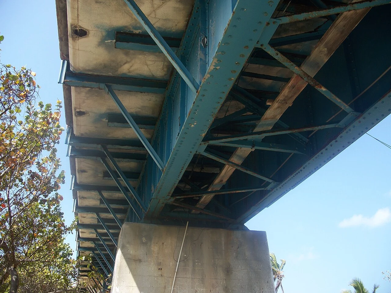
The bridge was assembled in four sections with steel-girder spans on concrete piers. An original swing span made room for boats between the Gulf and Atlantic. These details, and the parallel modern crossing, are why Old Seven is best understood as infrastructure with several chapters rather than a picturesque abandoned road.
After the 1935 hurricane, the former railroad alignment was converted to road use; the Florida Keys tourism authority dates the car-carrying conversion of Old Seven to 1938. The new highway bridge opened to traffic in 1982. Old Seven did not then become a single seven-mile public park: portions survived in different conditions and with different access rules. The Marathon-to-Pigeon-Key section later underwent major restoration and reopened to walkers and cyclists in January 2022.
The island beneath the old route once supported the railroad's work camp. Today Pigeon Key connects the big engineering story to buildings, exhibits and the people who worked here. If your interest is specifically the bridge's construction, start there; if you mainly want the open-water walk, allow enough time for the full return journey.
Walking and cycling: plan the return, not just the view
From the Marathon entrance, the renovated span is a linear park shared by walkers, runners and cyclists. Pigeon Key is roughly 2.2 miles away, making a full out-and-back roughly 4.4 miles before time on the island. There is little shade over the water. Start with water, a hat, sun protection and a willingness to turn around when conditions do not feel right.
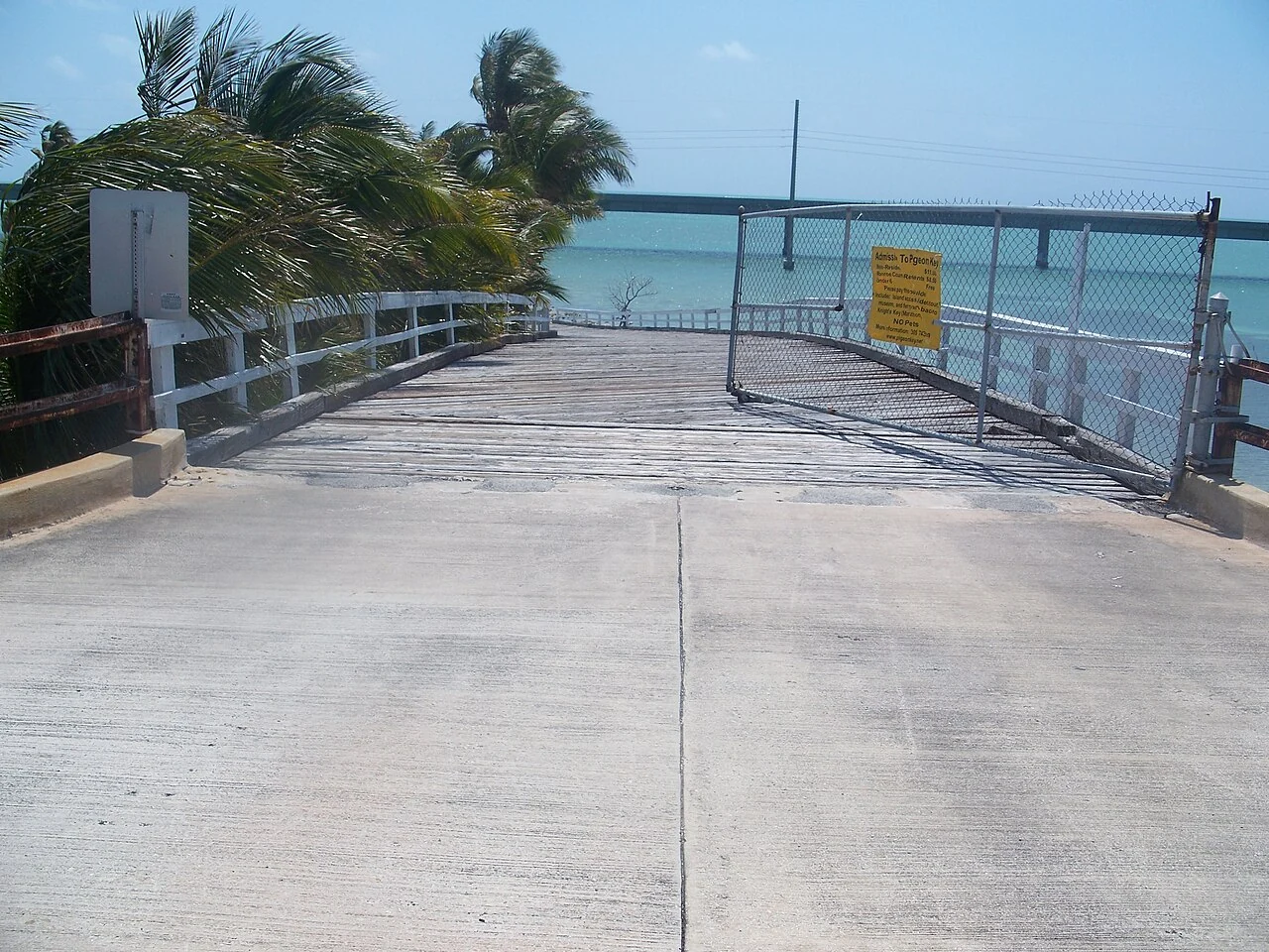
Keep to the open, managed route. A distant old bridge segment may appear tempting, but it is not evidence of public access. Respect signs, barriers and closures. If you are visiting Pigeon Key, its admission and tour arrangements are separate from using the bridge; verify them with the Pigeon Key Foundation. Tram availability and schedules can change, so never assume there will be a return ride if you choose to walk out.
Photography works best when you give yourself time to pause safely on the old span, rather than attempting it from a moving car on U.S. 1. The bridge is exposed to wind, heat and rapid weather changes. Conditions that look mild from a parked car can feel different a mile from shore.

Old Seven is the place to linger; the new bridge is the road.
The modern bridge carries active U.S. 1 traffic. For a walk or a photo stop, use the designated Marathon-side access to the restored old span and follow current local signs.
See the approach and parking notesLook beyond the postcard angle
Near Pigeon Key, the human scale of the railroad story becomes visible. The island supported construction workers during the rail project and now preserves buildings and exhibits related to that period. Views across the water also place the old and new bridges in one frame: a century's change in engineering, transport and the way travelers experience the Keys.
Wildlife sightings are possible but never guaranteed. Watch without feeding or disturbing marine animals. For historical background and current visitor guidance, start with the Florida Keys tourism overview and Old Seven walking guide. For an island-focused day, continue to our Pigeon Key page.
What “open” means here
Can you walk all seven miles of the old bridge? No. The renovated public route from Marathon to Pigeon Key is approximately 2.2 miles. The remaining historic structure is not a continuous public path. Treat gaps, barriers and closed stretches as genuine limits, not as detours to explore.
Is the bridge walk the same as a Pigeon Key visit? No. You can experience the restored bridge without entering the island. Pigeon Key is a managed historic site with separate visitor arrangements. If the museum and buildings are central to your day, check availability with the operator before making the walk.
Which bridge should a first-time visitor choose? If you are driving to Key West, you will cross the modern bridge as part of U.S. 1. If you want to spend time with the landscape and the railroad story, stop near Marathon and use Old Seven. Many travelers do both, but not by stopping on the highway itself.
When is the best time? Light, heat and wind all matter more than a universal “best hour.” A cooler period may make an exposed walk more comfortable; sunrise or sunset can be appealing for photography, but do not plan around a precise light window without checking weather and current access. For a guided island visit, the operator's schedule should set your timing.

Work out the return before setting off
The approximately 2.2-mile distance to Pigeon Key is one way. Walking out and back therefore means roughly 4.4 miles, before adding time spent exploring the island or walking to and from a parking place. A useful plan includes a turnaround rule: a time, a comfortable distance, or a point at which the group agrees to head back. Reaching the end is not a requirement for enjoying the bridge.
For illustration, covering the return distance at a steady 2 miles per hour requires about 2 hours 12 minutes of movement. At 3 miles per hour it takes about 1 hour 28 minutes. Neither estimate includes stops or describes what is appropriate for any particular person. The exposed setting and an unfamiliar level of heat can matter more than the flat surface. Budget for your actual group rather than a route application's default pace.
Pack water before starting, use sun protection and make a weather check part of the departure routine. Do not leave the least comfortable person to decide when the group is already committed to the full distance. A shared, explicit plan makes it easier to turn back early without anyone feeling that the visit has failed.
Use the Marathon entrance for the Pigeon Key walk
The restored walk most visitors are looking for starts on the Marathon side, near Knights Key. The island operator identifies parking at the bridge end and at its visitor centre; the correct choice depends on whether you are walking independently or checking in for a booked train tour. For a tour, use the destination stated by the operator rather than a generic map pin placed in the middle of the bridge.
The visitor centre is at 1090 Overseas Highway, Marathon, FL 33050. The operator asks train passengers to check in ten minutes before departure. That is a check-in allowance, not extra time for finding parking or correcting a wrong turn. Our parking and directions page links to the official arrival instructions.
Parking availability cannot be guaranteed. If a designated lot is full, do not wait in a through lane or use a restricted verge as an improvised space. Choose a lawful alternative or return at another time. A saved map can help with orientation, but on-site signs and current access restrictions take priority over the route suggested by an app.
Three details worth noticing on a slow walk
First, look at the relationship between the old alignment and the modern highway. A photograph can make them seem like a single object, but their purposes are different. One is carrying present-day road traffic; the restored part of the other provides a much slower way to encounter the channel. Keeping that distinction in mind helps explain why a visible piece of old bridge is not automatically an accessible path.
Second, look at the repeated supports and the way perspective compresses them into a dense line. From one viewpoint the structure seems almost solid; from another, water and light open between the supports. This is an easy subject for a small sequence of photographs without moving beyond a permitted viewing area. A wider frame records the setting; a tighter frame makes the construction easier to read.
Third, consider the maintenance behind a bridge that stands in a marine environment. The island's history is not only about a dramatic construction project. It also concerns the people who looked after the crossing after trains began running. Pigeon Key's transition from construction camp to maintenance community makes that less spectacular but essential work part of the story.

What changes when you enter Pigeon Key
The public bridge walk and the managed island visit are separate. Admission is required to enter Pigeon Key and use its facilities, even when you arrive on foot or bicycle. Do not plan to use the island as an automatic free toilet or refreshment stop without checking the visitor arrangements. The official visitor information explains arrival options.
If you want the historic tour, compare the train and walk-in options before leaving Marathon. The train reduces the walking commitment, while walking lets you set your own pace along the bridge. A booked train seat also has a schedule attached to it: ask about the return arrangements, not just the outward departure. A return ride for someone who walked out should never be treated as guaranteed.
Our island guide brings together the current tour link, the difference between admission types, the museum context and the rules that are easy to miss. Those details are especially useful for visitors with children, mobility requirements or a tightly timed onward journey.
Share a narrow experience generously
Walk predictably and leave space for people to pass. Before stopping for a photograph, look behind you and move out of the main line of travel where the permitted width allows. A group spread across the entire path can create a problem even when it is moving slowly. Keep children close and agree how the group will respond to an approaching bicycle or the authorised island transport.
For cyclists, this is a sightseeing route rather than a place to preserve a training pace through a crowd. Slow down early, communicate courteously and pass only when there is room. Secure loose items before starting. Wind can make a hat, camera strap or lightly packed bag more distracting than it was in the parking area.
Equipment does not remove the need to check current access. If you use a mobility device or a non-standard cycle, ask the responsible operator about the exact route and any restrictions. Do not infer that an activity is permitted because a different part of the wider Overseas Heritage Trail allows it.

Past photographs and present access are different evidence
The documentary photographs in this guide include dated views from before the 2022 restoration. They are useful for comparing the setting and structure, but they should not be read as a current access map. Railings, surfaces, signs, approach routes and the appearance of buildings can change. We retain the dates precisely because a convincing photograph can otherwise make an outdated condition look current.
For a varied set of pictures, try one landscape, one construction detail and one image that places Pigeon Key in context. Add a photograph of a sign or exhibit for your own notes if photography is permitted there. The aim is to remember what you learned, not simply to collect the largest number of nearly identical blue-water frames.
Keep wildlife viewing passive. Wait at a safe position, use binoculars or a zoom lens, and let an animal move out of view rather than chasing it along the railing. A sighting is a possibility, not an included feature of the walk. On a quiet day with no memorable wildlife, the bridge's scale, light and history remain ample reasons to visit.
You do not have to reach the island
A short out-and-back can be the right choice when the group has limited time or does not want an extended exposed walk. Agree a time to turn around, take the same care with water and weather as on a longer route, and leave enough margin for a slow return. There is no single point beyond which a visit becomes worthwhile.
For a second visit, choose a different emphasis rather than simply repeating the maximum distance. You might pay more attention to structural details, compare the old and new alignments, or book the island tour you skipped previously. The most useful measure of a visit is what you noticed and understood, not whether you reached a particular pin on a map.

How the modern bridge was assembled
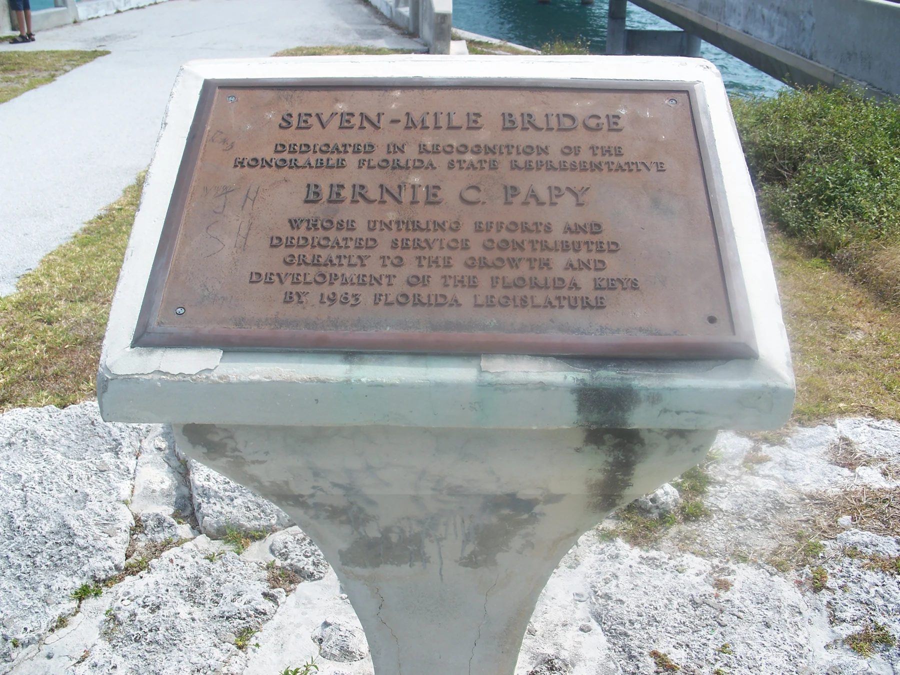
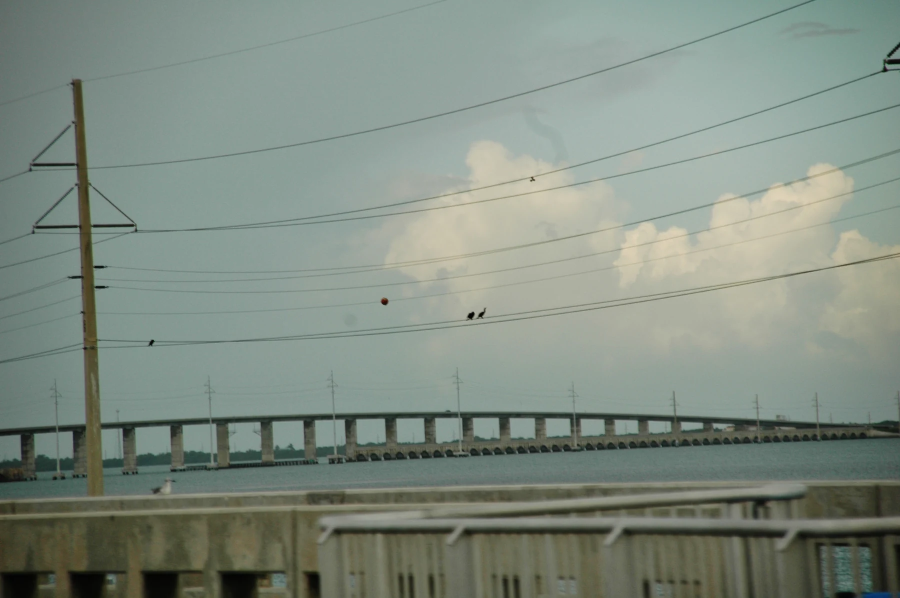
The present crossing is a different structure from Flagler’s railroad bridge. Designer FIGG describes a 1982 precast, post-tensioned concrete box-girder bridge, with 264 spans over a length of 35,867 feet. Factory-made concrete sections were assembled into spans, with internal steel tendons tying the pieces together. The repetitive system is what makes the long, low crossing legible from the shore: a sequence of supports and spans rather than one uninterrupted beam.
Use this schematic to recognise the structural idea, not to infer dimensions or maintenance condition. The Transportation Research Board’s 1982 record on span-by-span placement provides a technical starting point. For the earlier railroad, road conversion and surviving walking section, continue to the Old Seven history and visitor guide.